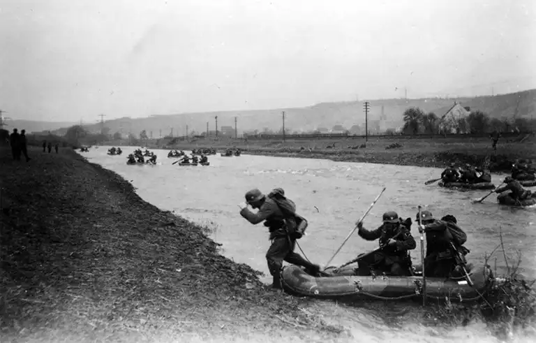
Wehrmacht mountain rangers practice crossing the Moselle River in the vicinity of the town of Tries. Western Front, World War II in Europe.
The Moselle (German: Mosel, French: Moselle, Luxembourg: Musel) is a river in France, Luxembourg and Germany, a left tributary of the Rhine. Length – 544 km, basin area 28,286 km².
The river originates on the southwestern slopes of the Vosges, or more precisely, on the western slopes of the Ballon d’Alsace mountain, then flows through Grand Est. Below it flows in the deep, narrow and winding Mosel Valley, separating the low-mountain massifs of the Eifel and Hunsrück. It flows into the Rhine in the city of Koblenz, forming the so-called German Corner (Deutsches Eck). The main tributaries are the Saar, Ruwer, and Aviera. From November to March there are frequent floods on the river, and summer low water is typical.
The river is navigable over a larger length, crossed by the Marne-Rhine canal, and connected by the Eastern Canal with the Saone River (Rhone basin). Several hydroelectric power stations have been built on the Mosel, there are numerous locks, and part of the riverbed is straightened by canals. On the river there are cities such as Nancy, Metz (France), Trier, Koblenz (Germany).
The name of the river comes from Lat. Mosella, meaning “small Meuse” (Latin: Mosa). The Moselle itself gave its name to two departments in France: Moselle and Meurthe et Moselle.
The River Moselle photo source: www.arkivinordland.no.
Location: Treis-Karden, Germany
Time when the photo was taken: April 1940
Photo credit: Rudi Margreiter